
A New Transit Era May Cost Almaty Dozens Of Buildings
 AI-generated illustration
Almaty has approved a major 2026–2030 transport development plan that includes new roads, metro expansion, LRT, SkyTrain, and possible demolitions, Orda.kz reports.
According to Krisha.kz, the city plans to extend and cut through 12 streets in 2026–2027. The work will affect major transport corridors, including Abay, Raiymbek, and Ryskulov avenues, as well as Sain, Tole Bi, and Tlendiev streets.
Additional road projects are still at the design stage. They include sections of the Talgar tract, Aldar Kose, Akhmetov, and Zakarpatskaya streets, as well as parts of Ryskulov Avenue.
Dozens of homes and commercial properties may be demolished for the projects. The listed sections include Abay Avenue from Auezov Street in Kalkaman to the city border, Sain Street from Ryskulov Avenue to Monke Bi Street, Tole Bi Street from Yassawi Street to the city border, Ryskulov Avenue from Ongarsynova Street to the city border, Tlendiev Street, Zhubanova Street, the Northern Ring, Raiymbek Avenue, Ongarsynova Street, Khmelnitsky Street, and Mukanova Street. Authorities are also expected to buy out land plots for infrastructure needs.
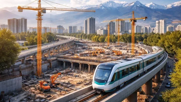
The metro expansion remains one of the key parts of the plan. The Kalkaman station is expected to open in 2026, and by 2030 the line is planned to reach the Barlyk market with three additional stations. The city also plans two new metro lines: one from Zhibek Zholy to the airport with eight stations over 14 km, and another from Sayran to the Severny transport hub in the Alatau area with 12 stations over 22 km. For the second line, houses may be demolished in the Almaly, Medeu, and Turksib districts.
Almaty also plans to develop light rail transport with a total length of 32.5 km. The first stage will run from the depot to Almaty-2 station and cover 18 km. The second stage, 14.5 km long, will extend toward the Barlyk and Eastern Gate transport hubs.
The city’s SkyTrain project is planned at 42 km in total, including a ring line. One line is expected to run from the Barlyk hub along Raiymbek Avenue through Sain Street, Al-Farabi Avenue, and the Eastern Bypass Road to the Kulja tract. The second line will be a circular route along Raiymbek Avenue.
BRT development will also continue. Seventeen kilometers of BRT lines are already under construction on Raiymbek Avenue, and by 2030 the total network is expected to reach nearly 300 km.
The city also plans new pedestrian crossings on Timiryazev Street near KazNU, near Almaty-2 station toward the Raiymbek Batyr metro station, across the A-3 highway in the Yntymak and Gate City area, and at the intersection of Ryskulov Avenue and the Kulja tract.
Original author: Daria Malkova
Read also:
Latest news
- From Driverless Trucks to Car Leasing: What Kazakhstan’s Government Discussed Today
- Kazakhstani Gets 3 Years for Fake Army Abuse Story
- Almaty Man Beaten After Being Mistaken for a Drug Courier
- PIN Code Parcel Pickup and Hybrid Mail: Kazakhstan Changes Postal Rules
- Kazakhstan Schools to Bring In Officers for New Constitution Classes
- Kazakhstanis Rescue Two Pelicans Exhausted by Extreme Heat
- 719 Million Tenge Tobol River Sand Mining Case Goes to Court
- Which Kazakh Product Is Finding New Buyers Abroad?
- Kazakhstan Seeks UNESCO Status for Mangystau Rock Mosques
- Fire Breaks Out in Almaty Region Mountains
- 19 Forest Fires Reported Across Kazakhstan’s Protected Areas
- Patient Fined for Threatening Kostanay Medical Worker
- Six Die from Gas Poisoning During Sewer Repairs in Pavlodar Region
- Kazakhstan Considers FIA Grade 1 Racetrack in Atyrau
- Drone Attacks Continue at CPC Terminal: Another Oil Tanker Hit
- Pension Savings Will No Longer Receive Inflation Compensation
- Kazakhstan to Expand Three Refineries and Build a New One
- Kazakhstan Resident Wins Court Battle Over Jennifer Lopez Ticket
- Kazakhstan Extinguishes Four Forest Fires as Heat Continues
- Kazakhstan Demands Action After Drone Attacks on Tankers Carrying Its Oil